A Guide for Riverfront Landowners
The Wood-Pawcatuck waterways are a Partnership Wild and Scenic River, meaning that they are managed through a collaborative effort between local communities, the National Park Service, and our Stewardship Council. As much of our rivers are along private land, local stewardship is key to maintaining the rivers’ health, flow, and history.
This page provides guidance for implementing Best Management Practices on private property to ensure our watershed remains resilient, and our rivers stay wild, scenic, and healthy.
Best management practices (BMPs) are proven, practical methods that we can use to maintain and improve the health of our rivers, prevent pollution, and solve environmental problems effectively. Some are structural, such as rain gardens. Some are actions or choices that result in better outcomes for the rivers. All of them are concrete actions that you can take on your property or in your community to positively impact the rivers we share.
1. Runoff
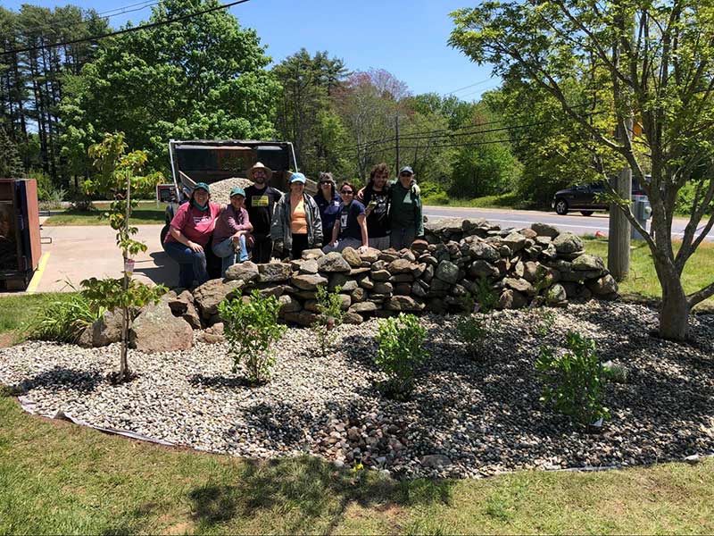
Roofs, driveways, and other impermeable (or impenetrable) surfaces create runoff, which can carry harmful “forever chemicals” into our waterways. They also can overload the river with nutrients, causing dangerous algal blooms and depleting oxygen.
Actions you can take:
- Reduce Chemicals: Grease-resistant and water-repellant products in your house and yard are “forever chemicals” that do not leave lakes and rivers once they get in. To limit further spread, follow EPA-recommendations for PFAS.
- Install a Rain Garden: Rain gardens are often shallow, landscaped stormwater depressions planted with native plants and shrubs. They allow soil and plant roots to filter out pollutants naturally. RI Stormwater Solutions has professional guides on how to make your own, or consider talking to your town about public rain garden sites.
- Redirect Drainage: Ensure that gutters from roofs or other yard drainage does not flow towards the riverbank or into the water.
- Reduce Impermeable Surfaces: Use crushed stone and shells, or permeable pavers for patios and driveways, which can slow runoff and allow the water to seep into the soil.
2. Riparian Buffers
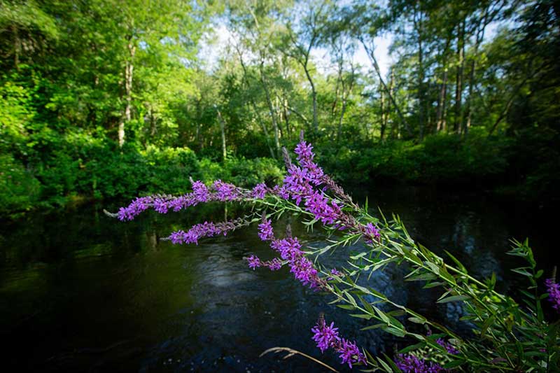
The plants at a river’s edge serve an important role to protect water quality and stabilize banks. This vegetation is called a riparian buffer, and acts as a natural filter along the river. Compromised buffer zones can cause increased erosion, sedimentation, and contamination by both chemical and organic pollutants.
Management Solutions:
- Maintain a “No-Mow Zone”: Deep-rooted native grasses and shrubs act as a filter and reinforce the river banks against erosion. A set distance from the river with intact vegetation is recommended. Both RI and CT require at least 100 feet of vegetated buffers along river edges.
- Retain Natural Deadfall: Native trout and other fish species find shelter in submerged logs and other natural debris. If a tree or branch falls into the river, leave it in place unless it is a hazard to navigation or other human activity.
3. Nutrient and Chemical Management
Plants use nutrients such as phosphorus and nitrogen to grow. However, excessive nutrients from human sources such as septic systems, lawn chemicals and road salt can cause algal blooms. These blooms often close rivers and lakes to recreation because there could be harmful bacteria (cyanobacteria) in them. These algal blooms can also reduce oxygen necessary for fish to survive..
Management Solutions:
- Monitor Septic Systems: Failing septic systems are a major source of nutrient excess and harmful bacteria. Pump and inspect home septic systems at least every 3-5 years.
- Manage Pet Waste: Pick up and dispose of all pet waste in trash, even in your own yard. Bacteria in pet waste and excess nutrients can be especially harmful in runoff.
- Choose low-impact lawn care products: With fertilizers, a little goes a long way. More is NOT better! Use only as much fertilizer as needed or plant native groundcover that doesn’t need fertilizing. This saves you money as well as protecting the rivers. . If possible, avoid using synthetic products for weed removal and fertilizer as well as chemical pesticides, especially near rivers.
- Snow and Ice Mitigation: Limit use of synthetic ice-melt and salt on impervious surfaces near rivers, and advocate for limits on use of road salt in your area. Less is more. Immediate snow-clearing is the best way to stop icy paths, not chemicals.
4. Low-Impact Landscaping
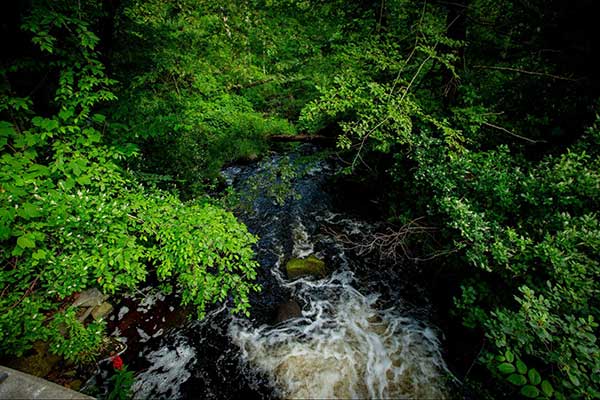
Erosion is increased by “hard armoring”, or using rigid structures such as walls and bulkheads to combat shoreline change. Mostly these structures do not actually reduce erosion and other problems, but push them downstream.
Management Solutions:
- Use Soft Armoring: To stabilize crumbling banks, use coir logs (biodegradable coconut fiber) and live cuttings of native trees. Living root systems can absorb the force of flowing water rather than deflecting, making them a more sustainable solution to erosion.
- Maintain and Improve Vegetation: In order to preserve habitats and keep banks cooled, thin branches rather than clear cutting. Preserve forest canopy wherever possible. Limit or eliminate impervious surfaces, such as roads, driveways, roofs and parking lots, near river banks.
- Path Management: Create “S” curve paths towards the water rather than straight lines. This can slow down the water and limits the direct flow of runoff from roads, driveways, trails, and yards.
5. Invasive Species Monitoring and Response
Invasive plants are non-native plants which have been introduced to a region and flourish without human intervention. The problem is that they lack natural predators in their new environment, giving them a big competitive advantage. They can outcompete and choke out native plants. Their biggest impact is that they make it harder for our local animals to find the food and habitat they need to survive.
Aquatic Species of High Concern
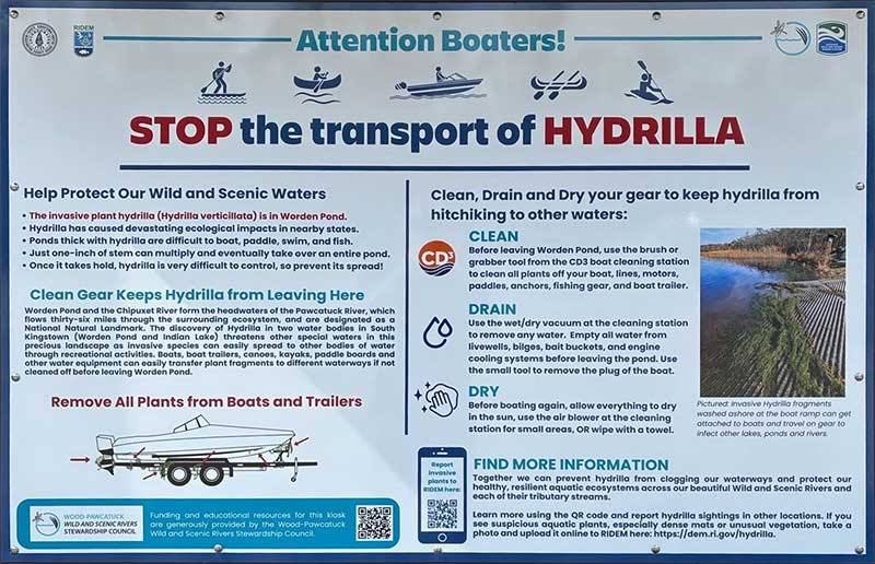
- Hydrilla: Known as the “world’s worst invasive plant,” hydrilla was recently detected in Worden Pond. It grows quickly and creates mats that cover the surface of the water. It has the charming ability to grow from broken fragments of the plant, so pulling it only encourages more plants. (See section on Hydrilla under Council Initiatives)
- Variable-Leaf Milfoil: This is an especially persistent plant that can be seen in most of the seven Wild and Scenic Rivers, especially in the ponds behind dams or where the water flow is slow. It outcompetes native aquatic plants and can disturb fish spawns.
- Fanwort (Cabomba): An aggressive submerged plant that thrives in slow-moving waters.
On land:
- Japanese Knotweed: Along river banks its weak root structure increases bank erosion during floods compared to native shrubs. It is often the only plant thriving where it grows.
Management Solutions:
- Clean, Drain, Dry: Before moving any boats or gear between water bodies, remove all plant fragments and drain standing water (including bilges and anywhere else water may collect) to stop the spread of invasive aquatic plants. Clean hulls and dry manually or better, wait 24 hours before launching boats in a new body of water.
- Mechanical Removal: For invasive plants like Knotweed that grow on land, do not mow or partially remove plants in areas where clippings can float downstream. Instead, remove each plant completely and be sure to take them far from waterways.
- Replace With Native Plants: Immediately replant with native plants where possible to prevent invasive species from re-growing in the empty space.
6. Managing River Flows
Artificial modification of river flows using dams or diversions can disrupt wildlife habitats and increase the damage from runoff as the rivers replenish.
Management Solutions:
- Rain Collection: Roof runoff can be collected directly in barrels for garden use. This reduces dependence on wells and groundwater, and diverts runoff. Solutions like rain gardens, also called bioretention, can filter runoff naturally by diverting rainwater directly into the soil of a garden bed before it can return to rivers.
- Smart Irrigation: Consider replacing lawn sprinklers with low-flow methods like drip irrigation to minimize runoff. Additionally, watering can be done in the early morning, when possible, to minimize evaporation and water usage.
- Protect Natural Flow: Fish and other smaller invertebrates can experience disruption to their movement and habitats from river and stream diversions and dams, even if they are temporary or informal. Avoid any actions that modify the flow of water.
Additional Regional Programs, Education and Training
Several regional initiatives offer additional training and resources both inside and outside the Wood-Pawcatuck Watershed. These links range from participatory science programs to resources on relevant environmental policies across the region, on both the topics discussed above, and other essential river health and wellness topics.
URI Watershed Watch Program
A water monitoring program using heavy citizen participation. Trained volunteers collect water quality information weekly at sites around Rhode Island (both coastal, and in lakes, ponds, and streams), including many sites within the Wood-Pawcatuck Watershed. Sites are selected by researchers in order to monitor all Rhode Island watersheds. Getting Involved With Watershed Watch
Save The Bay: Lawn Ambassador Program
The Lawn Ambassador program provides training for homeowners to maintain their yards without damaging nearby water bodies. Participants learn to reduce the nutrient runoff that causes toxic algal blooms. Join the Lawn Ambassador Program
Salt Pond Smart
Though outside the bounds of the Wood-Pawcatuck watershed, URI’s Salt Pond Smart program offers resources on management practices outside of their specialized training applicable to all rivers in the region. Resources from Salt Pond Smart
The Pollinator Pathway Project
This regional movement encourages landowners to use plants that are frequented by birds and insects while reducing lawn runoff. Resources are geared towards the Stonington and Westerly areas.
Rhode Island Natural History Survey (RINHS) Biodiversity Tracking
The RINHS offers data on ecosystem health and local species for Rhode Island. Scientific inventories, such as the Westerly Town Forest Survey, can ensure that plantings match the indigenous flora of our region.
URI Invasive Species Guide
The University of Rhode Island has a tool kit for RI residents which includes a guide to invasive species found in Rhode Island and how to identify them. Rhode Island Woods Landowner Toolbox
Fertilizer Regulation Storymap
Learn how fertilizer and other pollutant runoff is regulated in other areas of New England, and the types of policies and initiatives in place for nutrient pollution in order to identify effective potential policies in your area. Charlestown currently has guidelines in place for landscaping specifically. Fertilizer Policy Map
EPA Rain Gardens Guide
The United States Environmental Protection Agency provides a guide geared towards New Englanders on implementing and maintaining rain gardens for bioretention. EPA’s “Soak Up the Rain” Page
Department of Environmental Management (DEM) Invasive Species Guide
The RI DEM provides a guide to the identification, history, and management of common aquatic invasive species in Rhode Island streams, rivers, lakes, and ponds, including this fact sheet on milfoil. RI DEM Fact Sheet
RI Aquatic Invasive Species Response
The RI DEM also has an outreach program towards boaters focused on invasive species mitigation. This ranges from informational materials to a volunteer program for educating other boaters at public access points. This resource also encourages the recent increase in rinsing stations at boat launches across Rhode Island. RI DEM Response Efforts
Nature-Based Solutions
For anyone interested in more of the policy developments and broader changes necessary for ecosystem and hydrology preservation, there are federal guidelines for using nature-based solutions that protect communities that include an overview of the threats and solutions affecting our natural spaces. FEMA Community Resilience Guide
PFAS Mitigation
Though PFAS often is within your home before it is in your rivers, it is still possible to limit sources of it, as it contaminates drinking water and is found heavily in runoff. Rhode Island researchers have published guides on common sources for the chemical that has permeated groundwater, drinking water, and beyond. STEEP PFAS Actions
Key Terms
Algal Blooms: Rapid algae population increases due to excess nitrates that can cover water surfaces and deplete oxygen.
Best Management Practices (BMPs): The most effective and practical methods for individuals to prevent or reduce water pollution and protect the natural character of the river system.
Bioretention: Using landscape depressions to capture the flow of water, which can treat and filter runoff as it is collected.
Coir Logs: Biodegradable logs made of coconut fiber used for “soft armoring.” They are installed along a riverbank to provide a framework for native plants to grow while stabilizing the soil against erosion.
Daylighting: Opening a previously buried river or stream.
Floodplain: The flat land area adjacent to the riverbank. Floodplains act like sponges to absorb excess water during storms, reducing the velocity and height of downstream floods.
Hard-Armoring: Rigid, engineered structures, such as jetties or seawalls, that are intended to protect coastal land from waves or erosion. These can often redirect the force of water to cause erosion elsewhere.
Invasive Species: Non-native plants that outcompete indigenous flora and disrupt the local food web. Because they lack natural predators, they can quickly destabilize a river’s ecosystem.
Live Staking: A bank stabilization technique where cuttings from dormant native trees are planted directly into a bank to create a living root system for stability.
Nature-Based Solutions (NBS): Stewardship practices that mimic or restore natural processes to manage challenges like flooding and water quality.
Nitrates: Compounds necessary for plant growth that when found in excess can make oxygen absorption difficult.
Outstandingly Remarkable Values (ORVs): The specific ecological, recreational, or historical characteristics that earned the seven Wood-Pawcatuck rivers their federal Wild and Scenic designation.
Partnership Wild and Scenic River: A designation where the National Park Service works in collaboration with local towns and private landowners to manage the river, rather than through federal land ownership.
Permeable Hardscaping: Ground covers like porous pavers or crushed stone that allow rainwater to soak into the soil rather than creating surface runoff.
PFAS: A group of synthetic “forever chemicals” that do not break down in the environment. They enter water bodies and are difficult to remove, and can accumulate in fish rapidly.
Rain Garden: A shallow, landscaped depression that captures and filters stormwater runoff from roofs and driveways through soil and native plant roots.
Riparian Buffer: The vegetated “transition zone” between a yard and the river. A healthy buffer of native plants filters out pollutants and provides shade to maintain the cool water temperatures required by native fish.
Runoff: Rainwater that flows over the ground rather than into soil or sediment. Runoff is the primary vehicle for carrying nutrients, harmful bacteria, and chemicals from private property into the river.
Soft Armoring: The use of natural materials and native plants (such as coir logs or salt marshes) to stabilize a shoreline, as opposed to “hard” structures like concrete walls which can increase erosion elsewhere.
Watershed: An area of land that channels the flow of rivers into one centralized location.