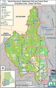
The Green Fall River is a forested river corridor and an environmental treasure. From its top, a long section of the river runs through Patchaug State Forest, Connecticut’s largest forest. At 27,000 acres, Patchaug extends through five towns and is in the Pawcatuck Borderlands area, which is part of New England’s coastal forest eco-region of dark skies.
Outstandingly Remarkable Values
Ecology – The Green Fall River is also part of the Great Thicket National Wildlife Refuge. Three-quarters of the Green Fall River flows within the Pachaug-Ledyard block of this six-state refuge system. The goal of this system is to help recreate and manage shrub land acreage, the return of young forests within mature forests, for over forty species of wildlife. The New England cottontail (NEC) is the Poster Child for this project, the region’s only native cottontail. Prairie warbler, blue-winged warbler, field sparrow, American woodcock and brown thrasher are the other leading species of concern found here. Birders extol over the bird population that have already been drawn to several Wyassup Road clearings. State and federal listed species and significant natural communities, as designated in the CT Natural Diversity Data Base, can be found along the entire length from Voluntown through North Stonington.
Bell Cedar Swamp, historically once a place for the felling and milling of giant cedar trees, is a highly significant Atlantic white cedar swamp that drains into Wyassup Brook, Spalding Pond, and Green Fall River. There are few trails through the rugged and wild eco-system. It is composed of decomposed peats and deep muck, stagnant slow-moving water, spectacular and critical Atlantic white cedar stands and other imperiled natural habitats that support rare and uncommon plants like green adder’s mouth orchid, nettled Chain fern, and Hessel’s Hairstreak butterfly.
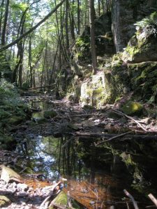
Geology/Hydrology – The Green Falls Rift Valley is a memorable, dramatic and majestic six-mile long fault line, with the river flowing beneath steep rocky ridge lines and embankments rising over 400’ on either side, with dark, green forests. This lineament is the result of a geological traumatization of the southern RI and CT borderlands that took place during the assemblage and subsequent breakup of the Pangea supercontinent.
Cultural – Extensive Native American ceremonial stonework can be seen throughout the river region. They include Manitou hassunash, and hassuneutunk, the walls and serpent effigy of the Narragansett Indians.
The rich flood-plain soils at the river’s southern end continue in agriculture with five farms in production. There are over 375 acres under purchase of development rights to ensure that these prime farm soils will be continued to be used only for agriculture.
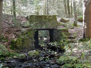
Today the Green Fall River flows peacefully through the northern forested areas and the quiet villages of its southern course. In times past these villages were very active with mills and other industries that accessed the water power provided by the river. A variety of mills and industry developed on the Green Fall River and its tributaries, Wyassup Brook, Pendleton Hill Brook, Peg’s Mill Brook, Palmer Pond Brook and Glade brook. The villages of Laurel Glen and Clark’s Falls were created around this available power. Iron works, shingle mills and lumber mills were built in the forested areas near to their raw material. Grist mills, fulling mills, woolen mills and other operations centered close to and in the villages. Along with the work places, there were schools, stores and churches. The industry based on the water power provided by the Green Fall River existed from early eighteenth century through to the late twentieth century when the Clark’s Falls Grist Mill ceased operations. The Clark’s Falls Mill is the only mill that still exists in North Stonington.


