

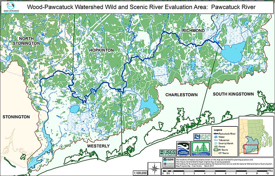
Pawcatuck River Map
Click on map to view it larger
See below for more maps
The Pawcatuck River starts at the outlet of Worden Pond and flows from east to west 35 miles to its mouth at Little Narragansett Bay.
Outstandingly Remarkable Values
Geology/Hydrology – This unique river was created by the action of the glaciers receding about 20,000 years ago. As the glacier slowly melted back from its furthest point near Block Island, the climate changed enough that it stalled along what is now the south coast of RI. For several thousand years the glacier kept moving sand and boulders down, depositing them in a recessional moraine. The Charlestown Moraine can be seen just north of Rte. 1 in South Kingstown, Charlestown, and Westerly, RI. The moraine forced the normally southerly flowing rivers to find an outlet toward the west, eventually heading south between Westerly and Stonington, CT.
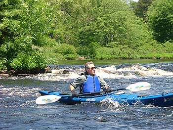
Pawcatuck River Paddle at Burdickville Dam. Photo by Denise Poyer.
Ecology – The presence of the moraine created extensive wetlands just to its north, including the Great Swamp, Indian Cedar Swamp, Phantom Bog, and Chapman Swamp. The Great Swamp is the largest swamp in New England. It supports large areas of swamp, forest and marsh vegetation. Bordered on the east and west by the Chipuxet and Usquepaugh Rivers, this expansive wetland provides unparalleled habitat for a vast biodiversity of plants and animals. It is the wildest part of RI. This area is a National Natural Landmark.
The Pawcatuck River is home to 67 species of fish, more than any other watershed in Rhode Island. The Wood-Pawcatuck Watershed Association and The Nature Conservancy have successfully reconnected anadromous fish, such as herring and alewives, to their historic spawning grounds at Worden Pond. American eels, a federal species of concern, are abundant throughout the river corridor. They inhabit the many streams and rivers that feed the Pawcatuck. By the end of 2018 Bradford Dam, one of three remaining dams, will be replaced by a nature-like fishway. This is a series of boulder weirs spanning the width of the river so that fish can incrementally make their way up stream. The other two dams, Horseshoe Dam in Richmond/ Charlestown and the Potter Hill Mill Dam in Westerly, now have fish ladders.
Cultural – Several important Native American archeology sites are found near the Pawcatuck River. The Great Swamp Massacre of Narragansett Indians by the colonists can be found in the Great Swamp Management Area. An historic battle between the Narragansetts and the Pequots was fought at the Lower Shannock Falls.
While there is only one productive mill along the river, remnants of nine historic mills, dams, and villages can be found throughout the river course starting at Kenyon Industries in the village of Kenyon, which straddles the Richmond-Charlestown border. The Pawcatuck River also passes through the villages of Shannock, Carolina, Burdickville, Alton, Bradford, Ashaway, and White Rock. The Pawcatuck estuary had an active shipbuilding industry for over 200 years, from 1681 to 1889. The estuary provided transportation to move coal and other goods into Westerly, including the famous Westerly granite out to the state of New York.
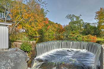
Horseshoe Dam. Photo by Tom Tetzner.
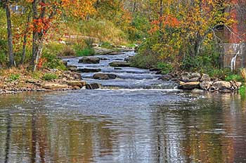
Lower Shannock Falls. Photo by Tom Tetzner.
Scenic/Recreation – Today the Pawcatuck River is well known for recreation. Starting at the mouth of the river, there are several marinas, a public boat launch, parks and nature preserves. Motorized boats are found primarily in the estuary including two short upstream stretches which are deep enough to accommodate them. Otherwise the Pawcatuck River is primarily enjoyed by canoeists, kayakers, and stand up paddlers. There are five state management areas in RI and CT, along with numerous conservation lands owned by The Nature Conservancy, Audubon Society of RI, and local land trusts. These properties are prime spots for hiking, biking, birding, and wildlife viewing. There are two river front campsites on the Pawcatuck River. They are in the Burlingame and Carolina Management Areas. Nine fishing and boating access points dot the river from Biscuit City Landing to the Westerly Town Dock.
Fish Passage Projects on the Pawcatuck River
The US Fish and Wildlife Service produced a story map highlighting some of the fish passage projects on the Pawcatuck River and their benefits: https://arcg.is/1GCD8j
Pawcatuck River Evaluation Area Maps
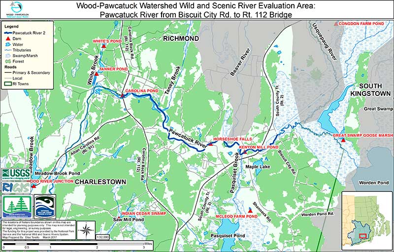
Biscuit City to Route 112
Click on map to view it larger
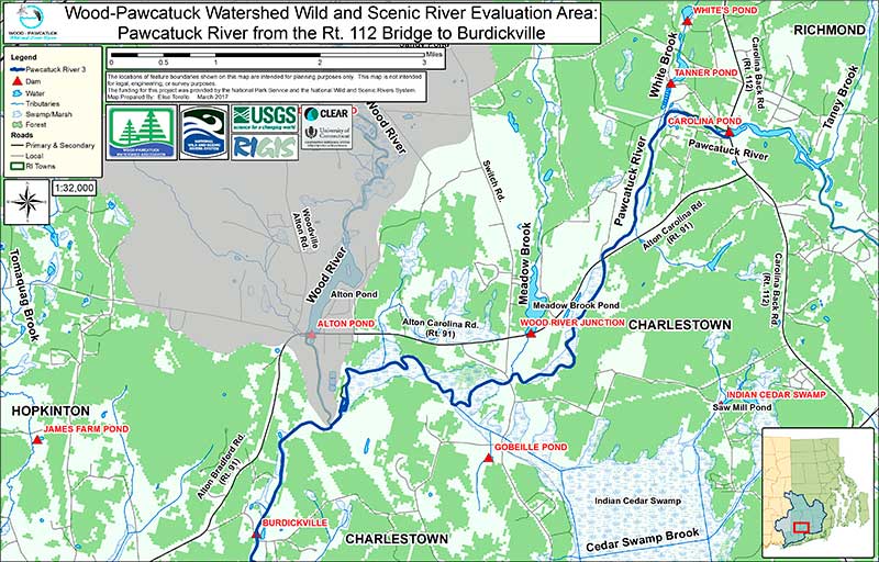
Route 112 to Burdickville
Click on map to view it larger
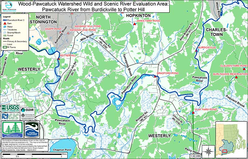
Burdickville to Potter Hill
Click on map to view it larger
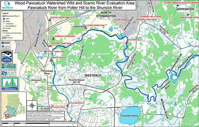
Potter Hill to Shunock River
Click on map to view it larger
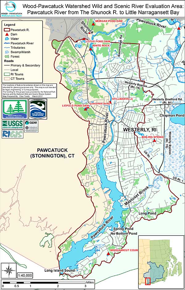
Shunock River to Little Narragansett Bay
Click on map to view it larger