

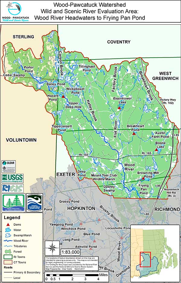
Wood River (Northern Portion)
Evaluation Area Map
Click on map to view it larger
The Wood River is the shining jewel of the region. From high quality ecosystems to cold water fisheries and unparalleled scenery, the Wood River is truly a Wild and Scenic river.
Outstandingly Remarkable Values
Ecology – The upper Wood River is an exceptional river ecosystem which supports the highest biodiversity of any river in New England. From the headwaters in Sterling CT to Frying Pan Pond in Richmond and Hopkinton RI, over 94% of the immediate land use surrounding the river is undeveloped and primarily forested. The river in the upper section (above Barberville Dam) runs through several thousands of acres of protected properties, including Arcadia and Wickaboxet State Management Areas, TNC’s Tillinghast Pond Management Area, URI’s Alton Jones Campus in RI, and the Pachaug State Forest in CT. It is part of the TNC Pawcatuck Borderland Project to protect large forested blocks and preserve the “dark sky” nature of the region. Local land trusts from Sterling CT and Exeter, West Greenwich, Hopkinton, and Richmond own preserves near the Wood River.
 While not as species rich as the upper section, the lower Wood River is still more than 75% undeveloped and contains many protected properties that support local wildlife. These include the Carolina Management Area, Black Farm Management Area, The Nature Conservancy properties, and local land trust properties.
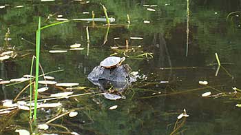
The Wood River and its tributaries contain a wide variety of wetland habitats. In addition to swamps and marshes there are also rare and unusual habitats for this region, including white cedar swamps, black spruce bogs, fens, and vernal pools. Besides supporting healthy populations of local native reptiles and mammals, the Wood River contains several state listed species of mussels, odonata and amphibians. Warblers, water fowl, raptors, and many other species of birds inhabit the variety of habitats and intact uplands. The clean cold water of the rivers provide ideal habitat for wild brook trout and the aquatic invertebrates that support them.
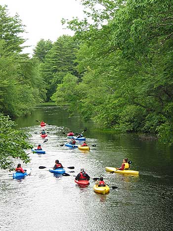
Paddlers on the Frying Pan Pond, on the upper Wood River.
Scenic/Recreation –
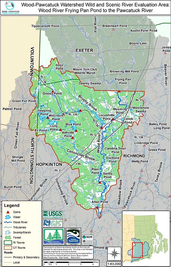
Wood River (Southern Portion)
Evaluation Area Map
Click on map to view it larger
The Wood River is a destination river for recreation. It is within an hour drive of anywhere in RI and eastern CT. Because of its forested banks and clean, cold water, trout can find pools of refuge even in the heat of summer, making this a regional destination for fly fisherman. RIDEM stocks brown, rainbow, and hatchery raised brook trout throughout its length. There are wild brook trout in all the tributaries and upper reaches of the river. A section of the river, from West Greenwich to Exeter, is reserved for catch and release fishing.
The same habitats that support so many species also offer incredible scenery and delight for outdoor enthusiasts. Canoeists and kayakers flock to the Wood River to enjoy the experience of a wild, natural river, with its many twists and turns and small class II rapids. Birders can find numerous species of birds along the river banks. Hundreds of miles of trails can be found in the state management areas and TNC and land trusts properties. The RI North South Trail system runs beside the Wood River and many of the tributary streams. People use the river to hunt for small game, deer, and water fowl.
Cultural – Two Native American tribes claimed areas near the upper Wood River for winter camps. The Mohegan used the section above Baily Pond in Sterling CT and the Narragansett used the region that started in RI. Along the Step Stone Falls are remnants of an old quarry were bedrock was easily accessible. The foundation for timber mill using these quarried rocks can be found slightly further downstream.
As soon as people settled the area they constructed mills. There are seven dams along the Wood River with additional dams on the river’s tributaries. These dams have a long cultural history. The early colonial settlers of the area used dams for gristmills, sawmills, tanneries, and ironworks. The numerous waterfalls and small ponds were well adapted for mill wheels. During the Industrial Revolution, from 1870 to 1940, textile mills replaced or were located beside pre-existing gristmills or sawmills. The new mills became the focus of mill villages and altered the physical character of the region. Hope Valley and Wyoming dams supported thriving communities which have been well documented and the Hope Valley and Wyoming Village Historic Districts are listed in the National Register of Historic Places. Two other dams on the Wood River, Alton and Woodville, supported smaller mill villages.
Geology/Hydrology – 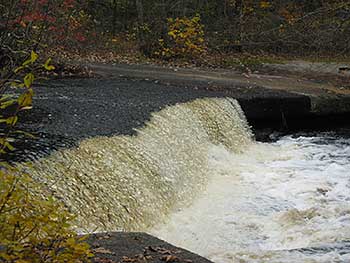 The lower Wood River has an extensive aquifer that supplies town wells for some Hopkinton and Richmond residents. In addition, the RI Water Resources board has identified several properties along river that have the potential to be future public wells. Several of these properties have been purchased and are now in permanent protection.