Richard Seager (Photos courtesy of the North Stonington Historical Society)
The Shunock River flows out of Gallup Pond. Gallup Pond is fed by the Phelps Brook which runs into Hewitt Pond from the north and then on to Gallup Pond. Gallup Pond is formed by a large dam, the location of an early mill.
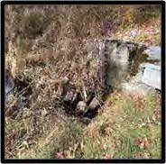
As the Shunock flows south it is joined by Yawbucks Brook. Continuing southeast, the River flows into Lewis Pond, also known locally as Hewitt Pond. This pond is also formed by a dam and was the site of another mill. It is likely that this was a grist mill due to its location within a large farm property. Until recently the mill turbine and headwater sluice were visible; they are now covered in concrete due to a recent bridge and dam repair resulting from the 2010 flood.
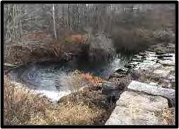
From here the river flows south toward the center of North Stonington Village. It is said that Samuel Richardson, an early settler, operated a mill on the Shunock as early as 1702. What the purpose of this mill was or where it was located is no longer known. The village was known in the 1700s as Avery’s mill and then as Milltown in the 1800s. It is the site of several old mill remains. Just up river from Main Street was the upper dam, of which there are just some stone remnants today. It was built to create a mill pond, raising the water level to power the mills in the center of town. There was a sluiceway canal from this pond along the north side of Main Street and under Wyassup road, providing some of the power for the Park mill and others.
The Main channel of the river passes under Main Street and joins with the Assekonk Brook and then passes under Main Street again and into a deep cut in the land. Towards the eastern end of this cut is the lower dam, which formed a mill pond that powered mills located there. Both the dam and the pond are still there; a mill race and turbine can still be seen.
North Stonington enjoyed a period of prosperity as a mill town, thanks to abundant water power supplied not only by the Shunock River but also by the Assekonk Brook, critical contributor of water power to the village. The Assekonk draws its water from the south slope of Wintechog hill and from the Assekonk Swamp.
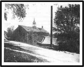
North Stonington Village supported a variety of mill operations and related local businesses from the late 1600s through early 1900s. Within the village there were numerous mills for various purposes. One of the earliest mills in the village was operated by the Avery family starting in the early 1700s. This was probably a grist mill. The village was called Avery’s mills during this early period. In the nineteenth century when the village was called Milltown there was a wide variety of mills operated in the village. The grinding of corn, the operation of saw mills, iron works, trip hammers, and nail manufacturing all took place in the village; there were also more sophisticated cotton and fulling mills.
While mill operations in North Stonington spanned three centuries, the early and mid-1800s saw the most intense industrial activity in the area. Woolen mills that carded wool for household spin- ning joined early gristmill and sawmill operations. These mills, in turn, helped foster the growth of John Wheeler’s blacksmith business, Wheeler Hake’s shoemaking enterprise, and Joseph Frink’s carpenter shop. The town became a prosperous mercantile center that also included dye houses, grocery stores, and dry goods stores.
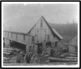
After flowing through the village the river continues generally to the southeast without additional mill sites until it passes under today’s route 184, the old King’s Highway that runs from Providence to New London. Downstream from where it to- day passes under the highway, the river provided power for the Vincent Sash and Blind factory from 1842 until the late 1880s. It is clear that the pow- er supplied by the Shunock River along with the its tributaries, the Assekonk Brook, the Phelps Brook and Yawbucks Brook, was central to the development of the village of North Stonington. A sawmill in about 1900 which was located near the lower dam. This mill was operated by the Park family from the late 1800s to the early 1900s.
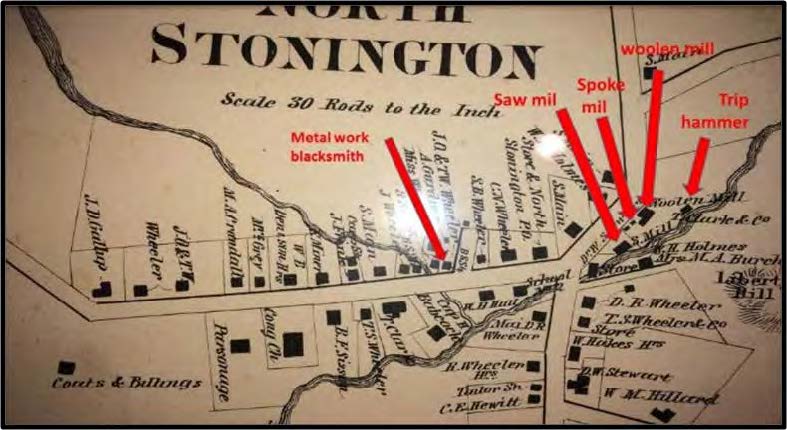
inaccurate–it does not illustrate the mill ponds formed by the upper and lower dams.