Richard Seager (Photos courtesy of the North Stonington Historical Society)
The Shunock River flows out of Gallup Pond. Gallup Pond is fed by the Phelps Brook which runs into Hewitt Pond from the north and then on to Gallup Pond. Gallup Pond is formed by a large dam, the location of an early mill.
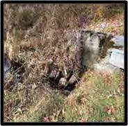
Part of the outrace
As the Shunock flows south it is joined by Yawbucks Brook. Continuing southeast, the River flows into Lewis Pond, also known locally as Hewitt Pond. This pond is also formed by a dam and was the site of another mill. It is likely that this was a grist mill due to its location within a large farm property. Until recently the mill turbine and headwater sluice were visible; they are now covered in concrete due to a recent bridge and dam repair resulting from the 2010 flood.
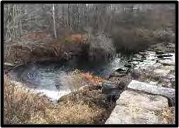
The dam structure
From here the river flows south toward the center of North Stonington Village. It is said that Samuel Richardson, an early settler, operated a mill on the Shunock as early as 1702. What the purpose of this mill was or where it was located is no longer known. The village was known in the 1700s as Avery’s mill and then as Milltown in the 1800s. It is the site of several old mill remains. Just up river from Main Street was the upper dam, of which there are just some stone remnants today. It was built to create a mill pond, raising the water level to power the mills in the center of town. There was a sluiceway canal from this pond along the north side of Main Street and under Wyassup road, providing some of the power for the Park mill and others.
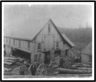
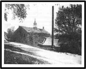
A sawmill in about 1900 which was located near the lower dam. This mill was operated by the Park family from the late 1800s to the early 1900s.
The Main channel of the river passes under Main Street and joins with the Assekonk Brook and then passes under Main Street again and into a deep cut in the land. Towards the eastern end of this cut is the lower dam, which formed a mill pond that powered mills located there. Both the dam and the pond are still there; a mill race and turbine can still be seen.
North Stonington enjoyed a period of prosperity as a mill town, thanks to abundant water power supplied not only by the Shunock River but also by the Assekonk Brook, critical contributor of water power to the village. The Assekonk draws its water from the south slope of Wintechog hill and from the Assekonk Swamp.
Park Mill at the end of its existence. After its collapse the Park Hotel was built on its site.
North Stonington Village supported a variety of mill operations and related local businesses from the late 1600s through early 1900s. Within the village there were numerous mills for various purposes. One of the earliest mills in the village was operated by the Avery family starting in the early 1700s. This was probably a grist mill. The village was called Avery’s mills during this early period. In the nineteenth century when the village was called Milltown there was a wide variety of mills operated in the village. The grinding of corn, the operation of saw mills, iron works, trip hammers, and nail manufacturing all took place in the village; there were also more sophisticated cotton and fulling mills.
While mill operations in North Stonington spanned three centuries, the early and mid-1800s saw the most intense industrial activity in the area. Woolen mills that carded wool for household spin- ning joined early gristmill and sawmill operations. These mills, in turn, helped foster the growth of John Wheeler’s blacksmith business, Wheeler Hake’s shoemaking enterprise, and Joseph Frink’s carpenter shop. The town became a prosperous mercantile center that also included dye houses, grocery stores, and dry goods stores.
After flowing through the village the river continues generally to the southeast without additional mill sites until it passes under today’s route 184, the old King’s Highway that runs from Providence to New London. Downstream from where it to- day passes under the highway, the river provided power for the Vincent Sash and Blind factory from 1842 until the late 1880s. It is clear that the pow- er supplied by the Shunock River along with the its tributaries, the Assekonk Brook, the Phelps Brook and Yawbucks Brook, was central to the development of the village of North Stonington. A sawmill in about 1900 which was located near the lower dam. This mill was operated by the Park family from the late 1800s to the early 1900s.
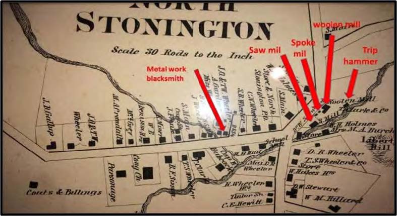
An 1866 map showing the village with some of the mills indicated. The depiction of the river is inaccurate–it does not illustrate the mill ponds formed by the upper and lower dams.
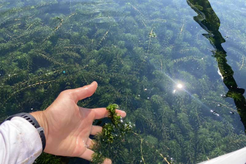
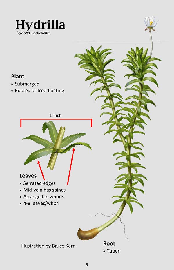
Hydrilla is the common name and the genus name of an intensely unwanted invasive plant that threatens our Wild and Scenic Rivers. It has been found in two water bodies in South Kingstown, Indian Lake and Worden Pond, and in West Greenwich in Lake Mishnock. This aquatic invasive plant is extremely difficult to manage. Hydrilla can successfully reproduce by seeds or roots like most plants, but just a fragment of about an inch of stem with a few leaves can grow its own root system to generate a whole new plant. It tolerates a wide range of temperatures, pH, salinity, and light conditions, and has a rapid, aggressive exponential growth rate, quickly outcompeting all native and non-native aquatic plants. A significant concern is the spread of this plant to other waterbodies by recreational activities. Boats, boat trailers, canoes, kayaks, SUPs, fishing gear and other water toys can easily transfer plant fragments to different water bodies if not cleaned before leaving the pond. The scope of this invader in the Wood-Pawcatuck System is frightening in that plant fragments leaving Worden Pond floating downstream could eventually extend its growth in the watershed to the brackish waters of Westerly. The popularity of water-dependent recreation in this watershed raises the level of concern, as transferring the plant on recreational devices to other waterbodies in the State and neighboring States could be disastrous.
What is being done
The Wood-Pawcatuck Wild and Scenic Stewardship Council (Stewardship Council) has been fully engaged working with the Rhode Island Department of Environmental Management (RIDEM) Office of the Director, Office of Water Resources, and the Fish and Wildlife Division on ways to mitigate and control the spread of Hydrilla. Federal funding, secured by RI’s US Senators, has facilitated RIDEM’s oversight of a treatment to attempt to eradicate and or control the infestation in Worden Pond. As reported in a RIDEM press release, treatments for the invasive plant, hydrilla, began on Friday, August 7, 2026 with periodic repeated treatments through November. The EPA-approved herbicide, Fluridone, will be used at a low-dose concentration to specifically target invasive hydrilla and lower any impacts on sensitive native plants. Fluridone is a slow-acting, systemic herbicide that specifically interferes with plant photosynthesis. Therefore, the treatments will not harm fish and wildlife, and the treatments will not restrict activities like boating, swimming, or fishing. However, because it is slow acting, in order to allow the herbicide enough time to saturate the entire plant and stop it from spreading, treatments will be repeated every few weeks to maintain the concentration through the end of its growing season into November.
In order to direct boaters away from the thickest areas of hydrilla infestation, buoys were purchased by the Stewardship Council and deployed by RIDEM. They guide boaters to a clear channel to access the unaffected center of Worden Pond.
The Town of South Kingstown has installed a boat cleaning station at the boat ramp on Worden Pond Road. Boaters are asked to clean their boats before and after the boats go into the Pond. A new hydrilla education sign and kiosk has been installed near the boat cleaning station to raise awareness about hydrilla. Most weekends during the summer a volunteer is also at the boat ramp to help explain the problem and remind people to clean their boats. (I thought it was DEM that installed the cleaning station and the kiosk. And DEM hired temporary staff for weekday greetings of boaters to educate and demonstrate how to use the cleaning station).
How you can help:
Clean all plants off boats, Drain water, and allow gear to Dry
To help educate the public about invasive aquatic plants, the Stewardship Council is developing a lesson plan for 5th grade teachers in public and private schools to incorporate into their science curriculum. The plan includes new vocabulary, fundamentals of ecosystems, interactive role playing, discussion groups, and independent writing by the students of what we as individuals can do to stop the spread of damaging invasive species. The focus is on Hydrilla because it is the current invasive species of most concern in RI and CT. However, the lesson plan would be applicable to any invasive aquatic species. The hope is that children will feel empowered to make a difference in their environment, in addition to helping spread the word about aquatic invasives to their friends and parents. In the near future we anticipate having a lesson plan for home-schoolers available on the Wood-Pawcatuck Wild and Scenic Rivers website.
These projects were made possible thanks to the support of the Rhode Island Department of Environmental Management (RIDEM) and funding from the Wood-Pawcatuck Wild and Scenic Rivers Stewardship Council. Their grants help bring these important educational resources to the community.